

Methodology of Field and Laboratory Research in Task 1
Sample collection according to the Polish Standard PN-R-04031. Analyses according to the PN-R-04033 standard. For determining nitrogen - PN-R-04028 standard. Soil property assessment methods: Egner-Riehm (phosphorus and potassium), Schachtschabel (magnesium), Mehlich III (phosphorus, iron, aluminum, microelements), pH reaction in KCl extract, organic carbon content, in accordance with laboratory procedures used in regional chemical-agricultural stations.
EnviAgri Model Concept:
The model will consist of four main blocks: Digitization, Standardization, Legislation, and Popularization (Figure 1). In DIGITIZATION, a Digital Farm Model (Figure 2) will be developed, fed with expert knowledge and data characterizing a specific farm (via the User Interface marked as A in Figure 3) as well as external constraints (via the Interactive Map marked as A1 in Figure 3). These include meteorological data from models such as UM from ICM UW, amounts of nutrients deposited in atmospheric precipitation, and soil data from IUNG-PIB. Each input of data triggers the execution of a script that launches the Computational Module B (Figure 3), consisting of 8 functional submodules/web applications (B1-B8) working in parallel:
- (B1) Nitrogen and phosphorus balance at the "farm gate" method – pilot version developed in Biostrateg III, a new web application will be created based on updated nitrogen and phosphorus content indicators in fertilizers and agricultural products, and current atmospheric data for each selected area [according to Pietrzak 2013];
- (B2) Estimation of nitrate leaching from soils for individual fields in the farm – simple pilot version developed in Biostrateg III, a new web application will be created based on the empirical model proposed by Aronsson and Ulen [2013], adapted to the soil-climatic conditions of Poland, mainly in the Pomeranian Voivodeship;
- (B3) Risk assessment of phosphorus loss due to water erosion/surface runoff based on potential erosion maps, soil phosphorus content, and land use – new web application;
- (B4) Determination of ammonia emissions at the farm level according to Pietrzak [2006] – new web application;
- (B5) Estimation of greenhouse gas emissions according to IPCC methodology [2006] – new web application;
- (B6) Preparation of soil organic matter balance at the farm level according to Ebertseder et al. [2014] – new web application;
- (B7) Assessment of drought risk for individual crops based on real and forecasted (up to 72 hours ahead) climatic water balance (CWB) values and maps of soil susceptibility to agricultural drought according to crop yield simulation models developed at IUNG-PIB in Puławy – new web application;
- (B8) Determination of economic indicators for crop production at the field scale and animal production at the farm level – new web application.
All web applications (B1-B8) will include specific algorithms along with the necessary indicators. The newly developed or improved empirical models, as elements of the low-emission education system, will be applied in practice, initially for assessing the emissions of selected farms in the Pomeranian Voivodeship, and later – for farms involved in the EnviAgri pilot project. After the successful completion of the computational process, Module B will transfer the results to Module C for presentation and post-processing (Figure 3).
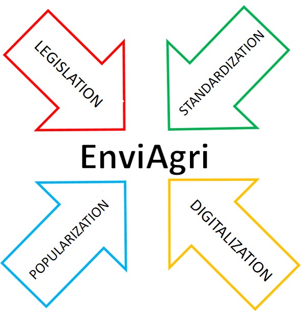
Figure 1. Block Diagram of the EnviAgri Model (source: IOPAN)
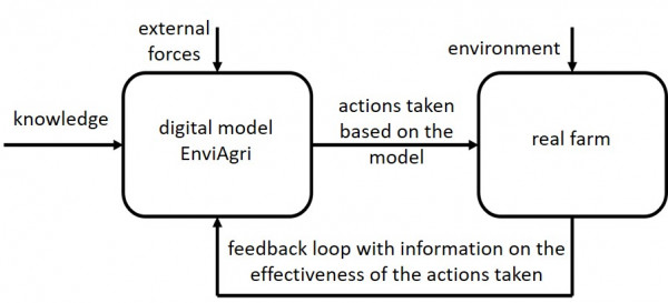
Figure 2. Structural Diagram Presenting the Operation of the EnviAgri Model (source: IOPAN)
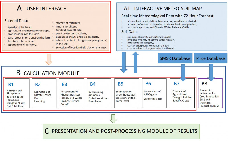
Figure 3. Structural Diagram Presenting the Digital Model of the EnviAgri System (source: IOPAN)